
Bhopal, Feb 19 (IANS) Madhya Pradesh witnessed a mix of unseasonal weather patterns over the past 24 hours, influenced by a persistent Western Disturbance over north Rajasthan and adjoining Punjab-Haryana regions, according to the India Meteorological Department (IMD) Bhopal center.
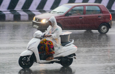
Rainfall occurred at isolated places in Sagar division, a few spots in Bhopal, Indore, Ujjain, and Chambal, and many areas in Gwalior, while the rest of the state remained dry.
Maximum temperatures plummeted markedly by 6.2°C to 11.4°C in Gwalior and Chambal districts, marking them appreciably to markedly below normal, down by 3.1°C in Gwalior and 7.3°C in Chambal.
In contrast, the Indore and Narmadapuram divisions saw highs 2.5-2.6°C above normal, while normal conditions prevailed elsewhere. Minimum temperatures dipped by 2.5-2.8°C in Ujjain and Chambal, but remained above normal by 1.9-3.0°C across Indore, Narmadapuram, Ujjain, Gwalior, and Chambal.
Statewide, the highest max was 34.1°C in Khandwa, and the lowest min was 9.2°C in Khajuraho. The heaviest rainfall amounts were 26.2 mm in Nalcha, 11.0 mm in Karhal, and 10.0 mm in Kolaras, with lighter showers in Indore (7.3 mm) and Bhopal (1.3 mm).
Gusty winds reached 63 km/h in Sheopur Kalan, accompanied by thunderstorms, lightning, and rainfall in districts like Morena, Bhind, Gwalior, and Indore.
Hailstorms struck Neemuch, Mandsaur, Sheopur Kalan, and Rajgarh. Map analysis from IMD visuals reveals stark regional divides. Observed maximum temperature anomaly maps show northern MP in cooler blues (below normal by up to 7°C), transitioning to warmer yellows and oranges in the south (above normal).
Minimum temperature maps indicate patchy pockets of above-normal temperatures centrally. Forecast rainfall distribution maps for February 19-20 depict isolated rain at places over northern and central districts, such as Rewa, Sagar, and Gwalior, fading southward by February 21-23.
Warning overlays highlight yellow zones for thunderstorms in isolated northern areas, aligning with synoptic systems like a trough from Gujarat to Haryana and a subtropical jet stream over northeast India.
Looking ahead, isolated rainfall or drizzle with thunderstorms/lightning is expected in Vidisha, Raisen, Ashoknagar, Shivpuri, Gwalior, Datia, Bhind, Rewa, Mauganj, Satna, Panna, Damoh, Sagar, Chhatarpur, Tikamgarh, Niwari, and Maihar until February 20 morning, with dry conditions elsewhere.
Warnings include gusty winds (30-40 km/h) with thunderstorms in Vidisha, Rewa, and Sagar clusters, and lightning in Gwalior and Chhatarpur groups. IMD advises staying indoors during storms, avoiding trees and water bodies, unplugging electronics, and securing livestock.
Farmers should protect crops, suspend field work, irrigate as needed, and prepare for summer sowing of sugarcane, groundnut, soybean, and maize. Northern maximum temperatures to rise gradually by 2-4°C in 48 hours, then stabilise; minimums unchanged for five days.
In Bhopal, expect partly cloudy skies with haze, winds at 20-22 km/h, and 26°C/14°C. This weather shift, driven by a feeble disturbance approaching the Himalayas from February 22, urges residents, especially in Indore, where light rain fell, to monitor alerts for safety.
–IANS
sktr/dan